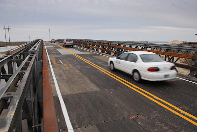
Showing posts with label repairs. Show all posts

Wednesday, April 3, 2013

Buxton

We understand that ocean overwash along N.C. 12 in the Outer Banks often makes it difficult for residents, visitors and businesses to get where they need to go efficiently. The state of emergency declared by Gov. McCrory helps us move forward with a short-term solution to protect this critical coastal highway at its most vulnerable location – the S-Curves.

Overwash at the S-Curves in March 2013
Currently, when overwash occurs at the S-Curves, it often forces N.C. 12 to close, making it challenging for people to get to jobs, education or medical appointments. A series of storms, including hurricanes Irene and Sandy, severely eroded the beach just north of Rodanthe.  Without the beach to act as a buffer, the strong surf threatens to undermine the structure and safety of the road.

That is why we have acquired $20.8 million in Hurricane Sandy emergency repair funds from the Federal Highway Administration to rebuild the beach at the S-Curves. Nourishment will provide much-needed protection to N.C. 12 until we can put a long-term solution in place in the coming years.

Although Buxton also experiences overwash, it was not included in the emergency declaration for several reasons. When overwash occurs, it washes water and sand onto N.C. 12, but it does not currently threaten the road’s integrity. Following recent storms, our crews have cleared the overwash off the road quickly without requiring repairs. In addition, N.C. 12 at Buxton does not qualify for federal emergency repair funds, and is not a candidate for state transportation funding for repair and protection at this time.

We have identified the section of N.C. 12 in Buxton as a “hot spot” that may see increased erosion in the future. We are studying this location to determine feasible long-term options for maintaining transportation along N.C. 12 if future conditions threaten the long-term viability of the existing roadway.

Thursday, November 29, 2012

UPDATE: 4WD Access Opened Ahead of Schedule!

Our crew completed the maintenance work on the four-wheel drive access detour two hours ahead of schedule and it is now open to traffic!

Big, big kudos to the folks out there who worked hard to shore  up the access detour!

NOTE: The weight restrictions on the 4WD access that were initiated Tuesday ARE still in place.

Monday, November 26, 2012

Now that it's calmed down a bit...

Over the Thanksgiving holiday, the wind, tide and overall weather situation calmed down some and if you're a regular follower of our Facebook page or Twitter account, you know the four-wheel drive access has not been closed quite as frequently.


Four-wheel drive access on Friday, Nov
While surf conditions have calmed considerably,  normal tides are still at the edge of the old road. Traffic through the holiday weekend was very heavy over the four-wheel drive access, which was able to remain open through high tide on Saturday and Sunday.  Today at Rodanthe sandbag installation began at the south end. 
 
So, with the improving weather, what's next?  
  
Our engineers are out looking at the trouble spots today and tomorrow, and are evaluating options.  As soon as details are available we will let you know. 

We've also had some questions regarding other issues related to NC 12, beyond the S-curves/Rodanthe trouble spot:
 
Bonner Bridge: Paving is expected to take approximately one day.  Once that's finished, the crews will then move down to the temporary bridge to begin work.

Signal timing @ temporary bridge: The timing of this signal will not be changed. There was more traffic over the holiday.  Things should be back to a more ‘normal’ rate this week. Also, paving will begin at this site tomorrow and the temporary signal might be replaced with flaggers during paving hours. 
  
Four-wheel Drive Access times: Dare County Sheriff’s Department is escorting vehicles until 10 p.m. Safety and traffic volume are the main reasons for the 10:00 p.m. closure time.

Wednesday, November 21, 2012

Recovery Planning

Short-Term Recovery Plans:
NCDOT is currently holding meetings and taking part in discussions with partner agencies to determine the most efficient and reliable way to restore traffic to N.C. 12 on Pea Island near Mirlo Beach. NCDOT also is actively partnering with US Army Corps of Engineers to pursue emergency nourishment along this same area.

However, until rough seas calm and crews can fully assess the impacts of the most recent Nor’easter, the department cannot make a final decision.

In the meantime, we continue to work hard to keep the four-wheel drive route open each day for as long as tidal conditions allow. Rapid changes do cause overwash and force intermittent closures to ensure motorist safety. Check road status.

Long-Term Recovery Plans:
NCDOT is currently developing long-term solutions for the breaches caused by Hurricane Irene on the Pea Island National Wildlife Refuge and in Rodanthe in August 2011. These same areas were also impacted by Hurricane Sandy and two Nor’easters this year. Hurricane Irene video

After holding several public meetings and collecting input from a panel of coastal engineers and scientists, NCDOT is considering the following options:


  • Building a bridge from Pea Island to Rodanthe. One possibility includes elevating N.C. 12 onto a bridge within the existing easement, which would end just north of the community center and not require beach nourishment. Another option is constructing an approximately 2.5-mile bridge that would extend into the Pamlico Sound and connect back to Rodanthe just north of the Historic District.
These long-term solutions are currently moving through the environmental planning process required by the state and federal governments.

Coastal Monitoring Program
To gauge the changes to Pea Island for years to come, NCDOT has instituted a Coastal Monitoring Program along N.C. 12. Using aerial photography and field studies, the department can note where shifts and weak spots are occurring. This information helps NCDOT decide where and when to make future improvements to N.C. 12 from the south end of the Bonner Bridge to Rodanthe.

The Coastal Monitoring Program was put into effect as part of the Bonner Bridge Replacement Project in December 2010. Therefore, any of the alternatives (beach nourishment, road relocation and bridging) previously studied as part of the original environmental analysis could be considered for future phases.

Friday, February 10, 2012

Update of Repairs to the Temporary Bridge - with Photos

As of yesterday afternoon, approximately 2,500 tons of armor rock have been placed around the bridge. The tides and currents have been favorable, allowing the rock to be installed against the new sheet pile that extends into the water from the south end of the bridge. More rock is needed against the existing sheet pile on the west side. Rock placement is also underway at the end of the new sheet pile on the east side.

Weather and tide permitting, the rock placement could be complete next week. Temporary lane closures began January 18th near the temporary bridge so crews could install protective measures to prevent erosion near the south end of the bridge.
More photos of the repair work on Flickr

Wednesday, January 4, 2012

Ocracoke Workshop Tomorrow

Tomorrow's the last of three public workshops to discuss long-term solutions for the breaches on N.C. 12 caused by Hurricane Irene.  The informal, drop-in style workshop begins at 5 p.m. at the Ocracoke Community Center. Starting at 4:00 p.m. we'll be live tweeting from the community center, via the @NCDOT and @NCDOT_NC12 Twitter accounts. Join the conversation by following the hashtag #NC12NextSteps. We can't promise we'll be able to answer all the questions, but we'll try! And remember, if you have any comments you'd like submitted for official review, please email them to to bsmyre@ncdot.gov - the Twitter conversation is informal, but informational, and we hope it will be fun! By the way, you can download the meeting packet here and the maps are on line as well. Hope to see you tomorrow!

Monday, December 19, 2011

NC 12 Update for 12/15/11


NC 12 Update for 12/15/11

The N.C. Department of Transportation met today with representatives of state and federal agencies to discuss which design options NCDOT should continue to study as viable, long-term solutions for the N.C. 12 breaches on Pea Island and in Rodanthe. The group, called the Merger Team, reached a general consensus to narrow down the options at both breaches.

“There are laws and regulations associated with some of the options that we are not likely to be able to meet,” said NCDOT Chief Operating Officer Jim Trogdon. “By focusing our efforts on the most realistic options, we can more efficiently develop long-term fixes for N.C. 12 that will provide a reliable way for people to get to jobs and education.”

At the Pea Island breach, the general consensus reached by the Merger Team includes eliminating the beach nourishment option, as well as the options to build a new road or bridge west of where N.C. 12 is currently. The remaining option would allow NCDOT to build a bridge where the road now stands.

At the Rodanthe breach, the Merger Team generally agreed to eliminate the beach nourishment option. The remaining options include building a bridge within the easement and building a bridge that would extend into the Pamlico Sound.

NCDOT also agreed to work on another potential option suggested by representatives of the U.S. Fish and Wildlife Service. At this time, the idea, which involves bridging from north of the Pea Island breach through the Pamlico Sound to Rodanthe, is conceptual in nature, and NCDOT will meet with USFWS in the coming days to more concretely map it out.

The Merger Team must sign a form officially agreeing to narrow the existing options and allow for the inclusion of any new options before the process can go forward. The group expects that to happen within the coming weeks.

Wednesday, November 9, 2011

Workshops Slated to Discuss Design Options

Mark Dec.5 and Dec. 6 down on your calendars.  We're holding two workshops expressly to discuss the options for permanently fixing the breaches on N.C. 12 on Pea Island and Rodanthe caused by Hurricane Irene.
We need your feedback on the ideas and we'll use it to figure out the best long-term solution for each breach.
Here are the specifics on the meetings:
  • Monday, Dec. 5, from 4 p.m.-7 p.m.
    Dare County Administration Building
    954 Marshall C. Collins Dr.
    Manteo  

  • View Larger Map

  • Tuesday, Dec. 6, from 4 p.m.-7 p.m.
    Rodanthe-Waves-Salvo Community Center
    23186 Myrna Peters Rd. 
    Rodanthe

  • View Larger Map
Drop in any time between 4 p.m. and 7 p.m.. NCDOT representatives will be there to explain the design options and answer any questions. Share your ideas, thoughts and suggestions with us!


New Aerials!

We love it when our photogrammetry guys go flying!


These were taken of the S-curves near Rodanthe (above) and the temporary bridge (below) yesterday, from 3,600 feet above ground.


Monday, October 24, 2011

Power to Pea

Cape Hatteras Electric Coop has begun receiving materials to construct a permanent transmission line at the Pea Island breach.

Check out the Facebook page...

Friday, October 21, 2011

Wednesday, October 19, 2011

Permanent Solutions


NCDOT staff and partners met today to begin work on the long-term solutions for the section of N.C. 12 hard-hit by Hurricane Irene.

You can read more here about the session, but here are some of the options discussed:
For fixing the largest Pea Island breach:
  • Beach renourishment;

  • Constructing a bridge within the existing easement; and

  • Building a bridge or road on a new location.

For fixing problems areas near Rodanthe:
  • Beach renourishment;

  • Building a bridge where the road now stands; and

  • Constructing a bridge or road on a new location.

Some of the next steps in the overall process:
  • Holding a panel discussion with experts in the fields of coastal science and engineering to learn about the changes in conditions along N.C. 12 resulting from Hurricane Irene, identify issues and constraints associated with future maintenance of the highway, and provide engineering advice on design parameters for long-term solutions at the two breach sites;

  • Hosting public meetings to formally present the options to citizens, gather their input and answer their questions;

  • Providing all feedback to the Merger Team and securing support to begin the permitting process; and

  • Presenting a realistic, fundable, buildable design plan to Gov. Perdue.

The process to develop permanent solutions for the two breaches on N.C. 12 is a continuation of work already under way as part of the Bonner Bridge Replacement Project. Phase one of the project involves replacing the 2.7-mile bridge over Oregon Inlet, which is currently in the design stage. The project also includes an active coastal monitoring program that uses scientific data to determine what types of improvements are needed on N.C. 12 between Pea Island National Wildlife Refuge and Rodanthe and when that work will occur. Using this program, NCDOT will enact phase two of the project, which will permanently fix the areas damaged by Hurricane Irene.

News Bits

A couple of things of note: there's a new deadline for applying for aid after Irene - Nov. 30

And - NCDMV's  mobile office will be back on Hatteras tomorrow and Friday.


Monday, October 17, 2011

NCDOT Now Takes a Ride on the Temporary Bridge!


This week's edition of NCDOT Now, the department's weekly video news update, is now available.

It takes you across the temporary bridge crews built over the largest breach of N.C. 12 on Pea Island caused by Hurricane Irene and shows the paving work done to reopen the highway to traffic as quickly as possible.

Friday, October 14, 2011

Now What?


Now that the temporary bridge is done and N.C. 12 is open all the way down Hatteras, what happens next? Stay tuned to this blog, ncdot.gov and on Twitter @NCDOT_NC12 for updates and info on the next phase of the post-Hurricane Irene era for this iconic roadway.  In the meantime, we'll try to keep you updated on other events and news happening in and around the area.  Feel free to send us suggestions for how you'd like us to stay in touch!

Monday, October 10, 2011

Wednesday, October 5, 2011

It's next Tuesday!

Or maybe sooner!

N.C. 12 Update 10/05/2011 


 The N.C. Department of Transportation will reopen N.C. 12 no later than Tuesday, Oct. 11 after the road has been closed due to the damage caused by Hurricane Irene in August.

 “Our hope is to open before then, but right now we are confident work will be complete on or before the 11th”, said resident engineer Pablo Hernandez.  “We will open to road earlier if we can.”

 At the Rodanthe breach area, crews completed paving the asphalt base for the road patches south of the mid Pea Island breach and began grading the sand for the roadway embankment leading to the southern end of the bridge.

At the temporary bridge location on Pea Island, crews worked all night and into the early hours to set deck panels at the north end of the bridge after it was completely lowered onto the permanent bridge bearing supports.

The southern half of the bridge is in the process of being lowered onto the bearing supports. Crews still need to install six of the 12 bridge bearing supports, anchor the bridge in place and finish installing deck panels; however, the following items are complete at the temporary bridge location:

Piling: all 82 piles driven.
Sheet Piling Bulkhead: all 726 linear feet installed.
Concrete Footings: all 12 footings poured.
Bridge Truss Spans: all 662 linear feet placed.